Geospatial Technology Solutions & Services
Customer Record
As the leader when it comes to geographic information system (GIS) technology, we provide the best service for mapping information and geographic applications.
A GIS is a computer system that integrates a general database with a mapping data system for efficient management and data analysis. Our services cover consulting, GIS & mapping, hardware, software and human resource training.
We also provide Light Detection and Ranging (LIDAR) technology to survey the height of a targeted area and a data conversion service between the GIS and the CAD systems of an organization that have different mapping data patterns so that they may interact and work together. We provide a GIS consulting service and conduct field surveys with modern and highly-accurate equipment. We provide photogrammetry and satellite data services as well as providing GIS training to enhance the capabilities of human resources to take them from a basic level up to become experts in this field.
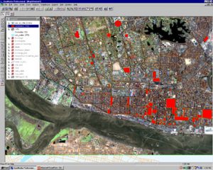
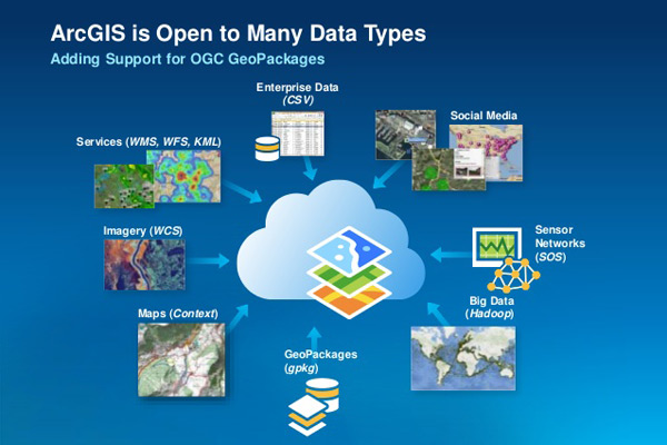
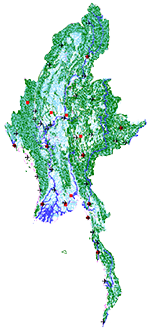
We use Esri’s ArcGIS, the world’s most-popular mapping and geographic software, for field analysis and we have combined perfect map information with this highly-accurate, quality mapping software. This has seen many practical uses, including around national security, disaster management, such as for managing areas that have been impacted by disasters such as the 2008 Nargis Cyclone and flooding, for planning, monitoring and development, for cyclone effected area.
Our service offerings include:
GIS Consulting Service:
By studying and analyzing customers’ requirements we provide an efficient application based on expertise that has been acquired over 15 years of experience working with many organizations, the Government, state enterprises, educational institutes and private companies.
Field Surveys: We perform field survey services for GIS.
Global Positioning System (GPS): Our global positioning system services help in the making of high resolution maps that have many applications.
Photogrammetry and Satellite Data: Our photogrammetry and satellite data services are derived from the knowledge, skills and experience of experts.
Digital Elevation Consulting and Services with Light Detection and Ranging (LIDAR): These are services involving surveys conducted using aircraft equipped with high resolution GPS/IMU systems and laser scanners that can generate geographic information both in terms of a digital elevation model (DEM) and a digital surface model (DSM). These surveys can be used for analysis to plan for flood prevention, to predict water flow, for public rescue operations and for city planning activities.
Remote Sensing:
Remote sensing is the analysis, classification and interpretation of the Earth’s surface by the use of satellite data coupled with experience and modern tools. We provide consulting and services such as project planning in the use of satellite data and around adjustment and processing systems as well as for data analysis.
GIS and Remote Sensing Training: This service covers GIS and Remote Sensing training conducted both in and outside the office with a variety of courses being offered.
Solutions include:
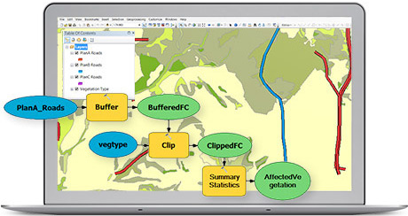
ArcGIS Desktop: There are lots of ways to make a map. But if people use your maps to make decisions that save money, time, or even lives, then you need to put science to work for you. Use ArcGIS for Desktop to build maps with up-to-date data, combined with deep analysis, and share them where they’ll have the most impact.
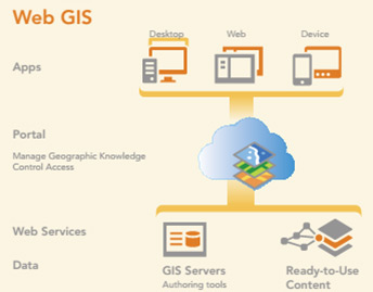
ArcGIS Server:
Use the ArcGIS web-based help to get the most up-to-date help online. Esri frequently updates the web help with new topics and additions to existing topics. These changes come from your suggestions and feedback from Esri Support.
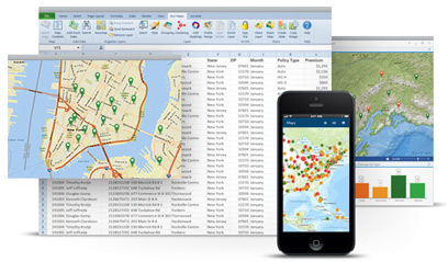
ArcGIS Online: This is an online map cloud service where users can create their own maps and share them with others for both personal and professional use. These are accessible at anytime and anywhere with the security and trust that is imparted by ArcGIS technology.
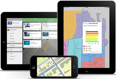
Mobile Applications: GIS and mapping applications on smartphones, tablets and handsets for any customer requirement
Geospatial Technology Solution & Services
Mandalay Technology GeoSpatial Services provides comprehensive solutions for spatial planning, field data collection, Geographic Information Systems (GIS) and remote sensing analysis, 2D and 3D visualization, data management, and web-delivered mapping applications.
Mandalay Technology has established a long history of production and delivery of high-quality GIS products, applications, analysis, and spatial data in flexible and user-friendly formats, customized to each client in order to meet all contract requirements. As such, we have established a proven track record of exceeding the unique GIS, Geospatial analysis, and data management needs of a broad spectrum of public and private entities. We routinely provide customized solutions for clients in government ministries, private companies, international organization, nongovernment organization, and academic institutions.
Our staff provides expertise in a wide variety of GIS applications and services:
- Map production and cartography
- Spatial analysis
- Remote sensing: satellite and aerial image analysis
- Field survey planning and execution
- Geo-database design, construction, and delivery
- Enterprise GIS design and implementation
- Spatial data management
- Site suitability & selection
- 3D modeling, visualization, and analysis
- Emergency preparedness planning
- GeoSpatial project planning and design
Geospatial Technology Solution & Services staffs are expert users of a multitude of software packages:
- ESRI ArcGIS for Desktop – ArcMap (spatial analysis, modeling, and mapping)
- ESRI ArcGIS for Server (web-delivered map content, GeoPortal construction, data visualization)
- ESRI ArcSDE (spatially enabled database and data storage manager)
- Microsoft SQL (enterprise database)
- ENVI (image processing & remote sensing software)
- AutoCAD
Free Software Download Link :
Download for profile
Contact Person
Su Su Wai
Executive Director
09977200103
susuwai@mandalay-technology.com